

This page last updated: December 2024
About This Map
The purpose of this map is to help people determine whether a location is or is not in a designated geographic area (for simplicity referred to as DGA). For more information, see our webpage.
A DGA is defined by statute as designated census tracts that have the highest unemployment and highest poverty in the State and former Enterprise Zones (EZ) in existence on 12/31/2011, designated in 2012 and any revision to an EZ prior to 6/30/2013, except census tracts within those EZs with lowest unemployment and lowest poverty levels, and former Local Agency Military Base Recovery Areas (LAMBRA) in existence on 7/11/2013.
The statute allows the Governor's Office of Business and Economic Development to designate up to 5 pilot areas within a DGA. On 4/24/2014, the Fresno, Merced, and Riverside Pilot Areas were designated. These pilot areas expired on 12/31/2017. There are currently no active Pilot Areas.
The Department of Finance (DOF) is responsible for the designated census tracts. They recently altered the list of designated census tracts for purposes of the New Employment Credit. The new designations will be effective beginning on 1/1/2025. Visit DOF's website for the lists of included and excluded census tracts.
Visit the Department of Housing and Community Development website for information about the former EZ and LAMBRA boundaries.
Instructions
Use this map to determine if a location is within a DGA by:
- Searching with a street address.
- Pointing and clicking on the map.
- Searching with latitude / longitude (geographic coordinate).
Look below to see the instructions for each.
Search by street address:
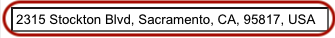
Step 1: Select the "Address" tab (shown below).

Step 2: Enter an address into the field as shown below, then select the "Search" button.
NOTE: The application supports "address suggestion". A list will be displayed with possible addresses that are selectable.
The results of the search will indicate if the location is in or out of a DGA. The example below shows the address to be "inside" a DGA and is likely to be eligible for the New Employment Credit.
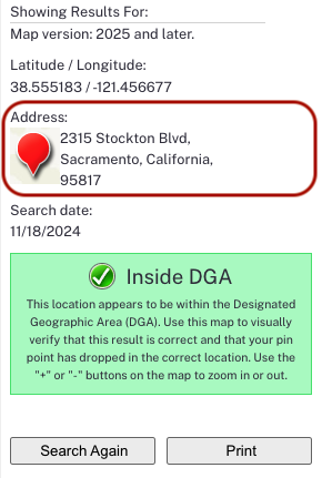
Select "Search Again" to start a new search, or "Print" to print the map.
Search by clicking on the map with a mouse.
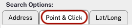
Step 1: Select the "Point & Click" tab (shown below).
Step 2: Zoom into the map by selecting the plus button, zoom out by selecting on the minus button.

Step 3: After positioning the map use the mouse to click on the map.
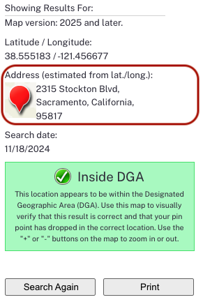
SPECIAL NOTE: The address shown in the results is an approximation based on where the map was clicked on. This is a "best-guess" of what the address might be for that location. This may not be the actual address of this particular location.
Select "Search Again" to start a new search, or "Print" to print the map.
Search by a latitude / longitude geographic coordinate.
Step 1: Select the "Lat/Long" tab (shown below).

Step 2: Enter the latitude and longitude coordinates in "decimal degrees" as shown below, then select "Search."
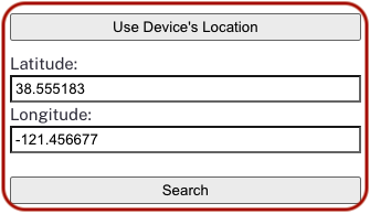
NOTE: The application supports the ability to obtain the location (latitude and logitude) from computing device. To use this option click on the "Use Device's Location" button.
The results of the search will indicate if the location is in or out of a DGA.
SPECIAL NOTE: With latitude/longitude searches, the address shown in the results is an approximation, or "best-guess" of what the address might be for that geographic coordinate. This may not be the actual address of this particular location.
Select "Search Again" to start a new search, or "Print" to print the map.
Map Changes
Starting late February (2014), we are keeping a running log of changes made to this map. If you have any questions, please contact the Franchise Tax Board.
| Change Date | Description |
| 12-12-2024 |
|
| 2-3-2023 |
|
| 11-6-2019 |
|
| 1-1-2018 |
|
| 2-20-2015 |
|
| 12-09-2014 |
|
| 10-24-2014 |
|
| 7-29-2014 |
|
| 6-12-2014 |
|
| 6-5-2014 |
|
| 6-2-2014 |
|
| 5-09-2014 |
|
| 4-24-2014 |
|
| 4-4-2014 |
|
| 4-2-2014 |
|
| 3-26-2014 |
|
| 3-4-2014 |
|
| 2-25-2014 |
|